Dig Deeper Blog,  Exhibits

Dig Deeper: How Do Archaeologists Know Where to Dig?

Dig Deeper is a monthly blog focusing on the basics of archaeology by taking a closer look at the exhibition Archaeology 101, which is currently featured at the Center.

Introduction

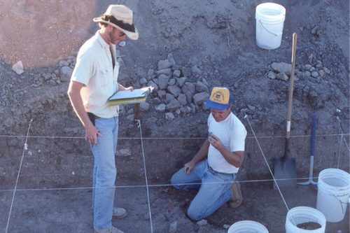
To determine where a site might be, archaeologists conduct a survey, which can include walking through a site and digging holes of similar depths at an equal distance apart from each other, known as shovel test pits, as well as GPS, resistivity meters, and ground penetrating radars. These methods allow archaeologists to determine where to dig without substantial impact or damage to the site itself.

Cultural Resource Management of Land Development

Most of the collections that come in to the San Diego Archaeological Center are excavated from land that is to be developed. By law, developers are required to hire a Cultural Resource Management (CRM) firm that will provide archaeologists (and other specialists like geologists and paleontologists) that are on site during the development process so that if any artifacts or ecofacts are found, they can be uncovered and studied. But what about sites that have nothing to do with a development?

Other Ways to Locate Sites

Archaeologists have many different ways that they locate sites. Researching historic records pertaining to a specific area is a great place to start. By knowing where previous human activity was, archaeologists can observe patterns. Many sites are visited more than once, so finding past record of any previous excavation or history, could also help archaeologists know where to continue their exploration.

Surveying

Before any sort of excavation is done at a site, the site is first surveyed visually. This is accomplished by establishing a grid system and then using that system to walk around scanning the ground for artifacts, such as ground stone, historic glass, or midden soil (or garbage dump). If midden is found, archaeologists know that the site was inhabited by humans at some point. Soil becomes darker and almost oily from organic materials that humans discarded in the past, making the soil easier to spot.

Tools Used for Surveying and Mapping Sites

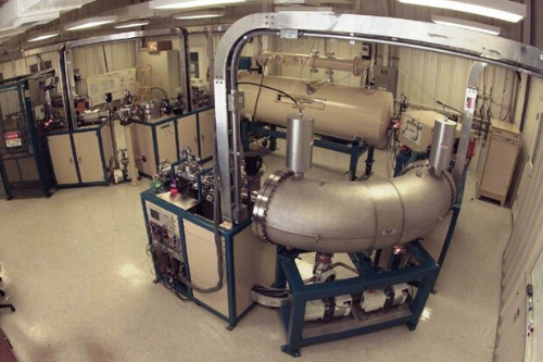
Geophysical tools can be incredibly useful for archaeologists to use while looking for site features, like foundations, floors, or walls. A resistivity meter locates sites by measuring electrical resistivity of the soil and any features or artifacts that might by underground. A wall that is buried underground will produce more resistivity than the soil that is around it. Magnetometers and ground penetrating radar (GPR) work similar to resistivity meters. They show the presence of artifacts and features by highlighting the differences in the soil. A tool you may already recognize, global positioning systems (or more commonly known as, GPS) or the total station that was introduced last month, give highly accurate data about the location and position of sites in the surrounding area.

Up Next

Come back next month to dig even deeper and explore the different ways in how archaeologists know who used the artifacts that they uncover during an excavation!

By Jessica McPheters, Collections Manager

Learn More

Archaeology 101 Exhibit

Volunteers work in the Center’s Research Library, cataloguing materials and organizing on a computer-based system.

Marketing and Administrative Volunteers assist the Development Office or Administration Office with data entry, updating marketing materials and clerical tasks. Computer experience is a plus.

Docents welcome visitors and answer general questions regarding the Center and exhibits. Docents staff the gift shop and help out with administrative and curatorial tasks.

Volunteers support event activities at the Center, such as the Annual BBQ, lectures, workshops, and fundraising events. Be a part of the party!

Volunteer provide support for K-12 programs offered at the Center. These are fun, hands-on programs that kids really enjoy. Teaching experience is a plus, but not required. Background checks are required.

Photogrammetry

With the assistance of Center staff, the intern will use photogrammetry to prepare one or more archaeological collections for digital preservation, as well as create a virtual museum exhibit for our Public Archaeology department. Per approval, special projects of the intern’s choosing are also available. During the research and planning, the intern will receive guidance as appropriate to their selected project. Prospective interns should already be familiar with photogrammetric procedures, and Agisoft Metashape.

Collections Management

With the assistance of Center staff, the intern will prepare one or more archaeological collections for curation. During the course of the internship, the intern will learn to identify artifacts and ecofacts common to the San Diego region, including lithics, ceramics, historical objects, and faunal, botanical, and mineral specimens. Center staff will instruct the intern on archaeological laboratory procedures such as basic artifact analysis, manual and computer cataloguing, storage requirements, and preventative conservation. In addition, the intern will become familiar with historical trends in archaeological practice in the San Diego area and will be introduced to current legal and ethical issues in archaeological curation as well as the concerns and rights of culturally affiliated groups with regard to archaeological materials.

Development and Marketing

Under the direction of Center staff, the intern will support the department in various activities, including, but not limited to, fundraising and grant research; e-newsletter development; social media marketing; and website maintenance. This internship will give the intern valuable, real-world experience in non-profit fundraising and marketing.

Geographical Information Systems in Archaeology

Prospective Interns must have completed three courses: Introduction to GIS, GIS Database Management, and Intermediate/Advanced Methods in GIS. The intern will be assigned a project where they will create shapefiles and maps for curated archaeological collections, museum exhibits, and/or public outreach using ArcGIS 10.6. Center staff will instruct the intern on archaeological GIS laboratory procedures such as computer cataloguing, storage requirements, and database management.

Library Science

With the assistance of Center staff, the intern will arrange and catalog materials in the Center’s library. During the course of the internship, the intern will take a leading role in the cataloging, sorting and storing of research files and creating user guides for these collections. Center staff will instruct the intern on archival procedures, computer cataloging, storage requirements, and preventative conservation.

Public Archaeology

Harness your passion for Public Archaeology and gain hands-on experience with K-12 museum field trips, lectures, and public outreach. Additional projects may include creating virtual museum exhibits and activities, assisting in the development and implementation of K-12 curricula programs, planning and presenting public facing content, or educational field trip content of your own design. Must be able to pass a Live Scan.